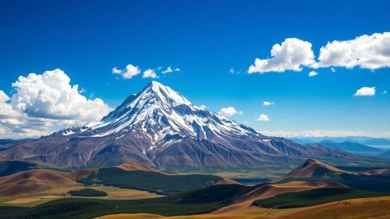
The United States has a long coastline. Its shores are touched by many big bodies of water. These seas and oceans shape the country’s geography, economy, and global role.
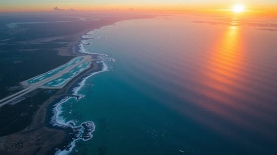
The US has many different maritime regions. To the east, the Atlantic Ocean stretches far. On the west, the Pacific Ocean meets the rugged coastline.
Down south, the Gulf of Mexico warms the southern states. And the Caribbean Sea touches US territories.
Did you know the US has sea borders with more countries than just its land neighbors? While Canada and Mexico share land borders, our sea borders touch nations like Cuba, the Bahamas, and even Russia! These watery borders create a complex web of international relations and economic zones.
The coastal waters of the United States are not just for pretty beaches. They’re vital for trade, defense, and protecting the environment. From busy ports to naval bases, these seas are key to American life. So next time you dip your toes in the ocean, remember – you’re touching a small part of America’s vast maritime domain!
USA seas: Major Bodies of Water Bordering the United States

The United States has a long coastline. We will look at the big bodies of water that shape our shores and define our waters.
The Atlantic Ocean and Eastern Seaboard
The Atlantic Ocean touches the east coast of the USA. It goes from Maine to Florida. This big water is key for the country’s sea activities and coastal life.
The Pacific Ocean and Western Coast
The Pacific Ocean meets the west coast. It goes from Washington to California. This ocean affects the weather and supports many sea creatures along the coast.
The Gulf of Mexico and Southern Waters
The Gulf of Mexico is by the southern states. It has its own special ecosystem. This water is important for fishing and oil in the USA’s sea areas.
The Caribbean Sea and Island Territories
The Caribbean Sea is around US territories like Puerto Rico and the US Virgin Islands. These warm waters make the area tropical and attract tourists.
| Body of Water | Bordering States/Territories | Key Features |
|---|---|---|
| Atlantic Ocean | Maine to Florida | Diverse marine ecosystems, major shipping routes |
| Pacific Ocean | Washington to California, Alaska, Hawaii | Deepest ocean, abundant marine life |
| Gulf of Mexico | Florida, Alabama, Mississippi, Louisiana, Texas | Rich oil reserves, important fishing grounds |
| Caribbean Sea | Puerto Rico, US Virgin Islands | Tropical climate, coral reefs, tourism hotspot |
Maritime Boundaries and Territorial Waters

The United States sea borders go far beyond its coastlines. They cover huge US ocean territories. These areas are shaped by complex maritime laws and global agreements.
Exclusive Economic Zones (EEZ)
The US has big Exclusive Economic Zones, 200 nautical miles from its shores. This area is about twice the size of California. It gives the US special rights to underwater resources.
The US Extended Continental Shelf (ECS) is huge, covering about one million square kilometers. It spans seven regions, including the Arctic and Atlantic coasts.
International Maritime Borders
US maritime borders are set by treaties and the United Nations Convention on the Law of the Sea. The US has borders with many countries, like Canada, Mexico, and Russia. These borders define where the US has full control, 12 nautical miles from the coast.
Disputed Maritime Territories
Some US ocean territories are still in dispute. There are issues in the Arctic Ocean with Canada and in the Beaufort Sea with Russia. Also, there are unresolved claims in the Caribbean, like Navassa Island and Bajo Nuevo Bank.
These disputes show how hard it is to define American sea territories globally.
| Maritime Zone | Distance from Shore | US Rights |
|---|---|---|
| Territorial Sea | 12 nautical miles | Full sovereignty |
| Contiguous Zone | 24 nautical miles | Limited control |
| Exclusive Economic Zone | 200 nautical miles | Resource rights |
| Extended Continental Shelf | Beyond 200 nautical miles | Seabed resources |
Ocean Characteristics and Geographic Features
The USA seas and coastal waters are full of variety. American oceans cover a huge area. Each part has its own special traits that affect marine life and human actions.
The Atlantic Ocean borders the eastern coast. It has the Mid-Atlantic Ridge, an underwater mountain range. This range makes the ocean floor complex, with deep basins and plains.
The Pacific Ocean lies on the western coast. It’s huge and has the Ring of Fire. This area is very active with volcanoes and earthquakes.
The Gulf of Mexico is a sea that’s mostly enclosed. It has a wide shelf full of sea life. The Caribbean Sea, with many islands, has deep trenches. The Puerto Rico Trench is the deepest in the Atlantic, over 8,000 meters deep.
| Ocean Region | Key Feature | Depth (meters) |
|---|---|---|
| Atlantic Ocean | Mid-Atlantic Ridge | 3,926 (average) |
| Pacific Ocean | Ring of Fire | 4,000 (average) |
| Gulf of Mexico | Continental Shelf | 1,615 (average) |
| Caribbean Sea | Puerto Rico Trench | 8,376 (deepest) |
These features are key for marine life, climate, and jobs by the sea. Knowing about them helps us manage and protect American oceans better.
Strategic Importance of American Maritime Regions
The US maritime regions are key to our national security and economic growth. They cover vast areas along our coastlines. These areas are crucial for our naval power and business activities.
Military and Defense Considerations
The United States Navy is strong in our national marine areas. It has about 290 ships, including eleven aircraft carriers. This makes it the world’s strongest naval force.
The navy plans to grow its fleet to 381 manned ships by the 2030s. This will boost its power in US maritime regions.
Economic Significance
American shorelines are vital for global trade. Over 80% of world trade moves by sea. Yet, less than 1% of global shipbuilding happens in the US.
Also, few trading vessels fly the American flag. This shows we need to strengthen our maritime economic presence.
Environmental Protection Zones
National marine areas USA protect vital ecosystems. They allow for sustainable use of resources. The Navy plans to add 150 unmanned vessels by 2045.
This will help monitor these zones better.
| Aspect | Current Status | Future Goal |
|---|---|---|
| Navy Fleet Size | 290 ships | 381 manned ships by 2030s |
| Aircraft Carriers | 11 | Maintain global leadership |
| Unmanned Vessels | Limited | 150 by 2045 |
| US Shipbuilding | Less than 1% globally | Increase capacity |
US Maritime Territories and Dependencies
The United States has a big presence in the oceans through its territories and dependencies. These areas are key to American influence in the seas. They help define the United States’ sea borders. Let’s look at the different territories and why they matter.
Pacific Island Territories
In the Pacific, the US has several important territories. Guam is a major military base. American Samoa and the Northern Mariana Islands also play a big role. These places help the US in the ocean and offer economic benefits.
Atlantic and Caribbean Possessions
The Atlantic and Caribbean are home to US territories too. Puerto Rico is a big one, and the US Virgin Islands help in the Caribbean. These places boost the US economy and attract tourists, helping local businesses.
Disputed Island Claims
Some US claims in the ocean are disputed. Wake Island in the Pacific is one example. The US also claims some islands under the Guano Islands Act, but other countries disagree. These issues show how complex sea boundaries can be.