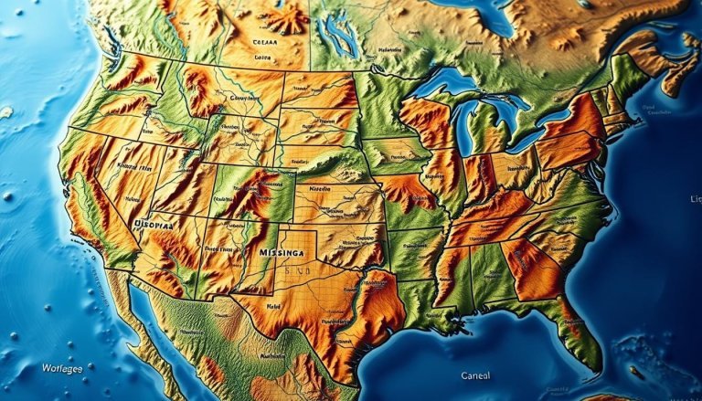
The United States has a very diverse landscape. It has both mountains and vast flat areas. This mix of terrains makes the USA’s topography very interesting.
The east has the rolling Appalachian Mountains. The west has the towering Rocky Mountains. The USA has over 200 mountain ranges, each unique.
The Appalachian Mountains are 2,000 miles long. The Rocky Mountains are even longer, at 3,000 miles. These mountains contrast with the flat Interior Lowlands and the Atlantic Coastal Plain.
This mix of mountains and plains has shaped American history. It has influenced settlements and westward expansion. The USA’s diverse landscape is a treasure for both locals and visitors, full of natural wonders.
Geographic Diversity of the United States

The United States has a wide range of landscapes. From coast to coast, it shows many terrains. These terrains make its geography unique.
Atlantic Coastal Plain and Interior Lowlands
The Atlantic Coastal Plain runs along the eastern seaboard. It’s a flat area with big cities like Boston and Miami. Further inland, the Interior Lowlands start.
These fertile lands, including the Great Plains, are key for food. The Midwest grows lots of corn, soybeans, and wheat.
Major Mountain Ranges Overview
The U.S. has many impressive mountain ranges. The Appalachian Mountains, very old, go through the east. In the west, the Rocky Mountains stand tall.
Along the Pacific coast, the Sierra Nevada range adds to the mountains. These mountains offer beautiful peaks and diverse life.
Regional Elevation Patterns
Elevation changes a lot across the nation. Death Valley in California is below sea level. Denali in Alaska is over 20,000 feet high.
This change affects climate, ecosystems, and where people live. It shapes the country in many ways.
| Region | Key Features | Climate |
|---|---|---|
| Midwest | Great Plains, fertile farmlands | Continental |
| Southwest | Deserts, Grand Canyon | Arid to semi-arid |
| Pacific Northwest | Rainforests, Cascade Range | Temperate |
USA Mountains: Major Mountain Systems

The United States has many mountains that make its landscape beautiful. From east to west, these ranges offer stunning views and special geological features.
The Appalachian Mountain Chain
The Appalachians stretch 2,000 miles from Newfoundland to Alabama. They are among the oldest mountains on Earth. The Great Smoky Mountains, part of this range, attract millions each year. They are known for their misty peaks and rich wildlife.
The Rocky Mountains System
The Rockies cover 3,000 miles from Canada to New Mexico. This vast range has over 100 separate chains. Colorado has 53 peaks over 14,000 feet, with Mount Elbert being the highest.
The Pacific Coast Ranges
The Pacific Coast Ranges include several sub-ranges. The Sierra Nevada, home to Mount Whitney, is the highest peak in the contiguous U.S. The Cascade Range, part of the Pacific Ring of Fire, has volcanic peaks like Mount Rainier. It has the largest glacier system in the lower 48 states.
The Alaska Range and Denali
Alaska’s mountains are much bigger than those in the lower 48. The Alaska Range has Denali, North America’s tallest peak at 20,310 feet. This giant dominates Denali National Park’s skyline, drawing climbers and nature lovers worldwide.
| Mountain Range | Highest Peak | Elevation (feet) |
|---|---|---|
| Sierra Nevada | Mount Whitney | 14,505 |
| Cascade Range | Mount Rainier | 14,411 |
| Rocky Mountains | Mount Elbert | 14,440 |
| Alaska Range | Denali | 20,310 |
Formation and Geological History
The USA’s diverse landscape comes from millions of years of geological processes. Plate tectonics, volcanic eruptions, and glaciation have shaped mountains across the country.
Tectonic Plate Movements
Tectonic activity has shaped America’s mountains. The collision of the North American and Pacific plates formed the Rockies. This started over 1.7 billion years ago.
Laurentia collided with volcanic island arcs, adding southern Arizona by 1.4 billion years ago.
Volcanic Activity Impact
Volcanic eruptions have greatly influenced the USA’s mountains. The Cascades were built by repeated eruptions. This built mountains layer by layer.
In southeastern Arizona, caldera-forming eruptions in the Jurassic Period created structures like the Montezuma Caldera.
Erosion and Glacial Effects
Glaciation and erosion have sculpted America’s mountains. The Appalachians’ rounded peaks show erosion’s work. Glacier National Park, in the Rocky Mountains, shows ice’s power.
The park’s landscape was shaped by four stages: siltation, tectonic collisions, faulting, and glaciation. The Ice Age, starting about 2 million years ago, carved out the park’s dramatic features. This happened through the advance and retreat of massive ice sheets until roughly 10,000 years ago.
Notable Mountain Peaks and National Parks
The United States has many stunning mountain peaks and national parks. These places offer amazing views and fun activities for millions each year.
Highest Peaks in Different Regions
Across the country, there are many tall peaks. Mount Rainier in Washington is 14,411 feet high. California’s Mount Whitney is even taller at 14,505 feet.
In Alaska, Denali is the highest at 20,310 feet. It’s the highest peak in North America.
Protected Mountain Areas
National parks help keep these mountains safe. Yosemite, with its cliffs and waterfalls, drew nearly 4 million visitors in 2023. Grand Teton, known for its peaks, welcomed over 3.4 million.
Rocky Mountain National Park had 4.1 million visitors. They came to see its alpine tundra and valleys.
Popular Mountain Recreation Areas
These parks have lots of activities for outdoor lovers. Yosemite has trails through sequoia groves. Grand Teton is great for rock climbing.
Rocky Mountain National Park is perfect for seeing wildlife and driving on Trail Ridge Road. Glacier National Park has over 150 peaks above 8,000 feet. It’s known for the Triple Divide Peak, where water flows to three oceans.
| National Park | Visitors in 2023 | Notable Features |
|---|---|---|
| Yosemite | 4 million | Granite cliffs, waterfalls |
| Grand Teton | 3.4 million | Jagged peaks, alpine lakes |
| Rocky Mountain | 4.1 million | Alpine tundra, glacial valleys |
| Glacier | 3 million | 150+ peaks, Triple Divide Peak |
Conclusion
The USA topography is a mix of flat plains and high mountains. The ancient Appalachians and the rugged Rockies have shaped the nation. They also affect the climate and ecosystems.
The Sierra Nevada, over 250 miles long, shows the country’s mountainous beauty. Its highest peak, Mount Whitney, reaches 14,494 feet.
Mountain ranges in the USA are key to the nation’s geography. They cover 24% of North America. These mountains act as natural water towers and home to unique ecosystems.
They were shaped by tectonic movements, volcanic activity, and glacial forces. This has created a beautiful landscape of peaks, valleys, and plateaus.
The landscape diversity of the United States is more than just beautiful. Mountains affect weather, support wildlife, and provide resources. They are also popular for outdoor activities, attracting millions each year.
Understanding this varied topography helps us appreciate our natural heritage. It also helps us face environmental challenges today.